Demystifying Planning: Floodplain, Floodway, Flood Fringe
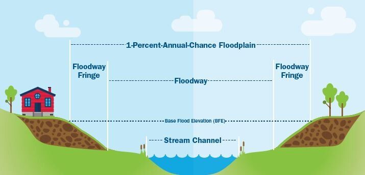
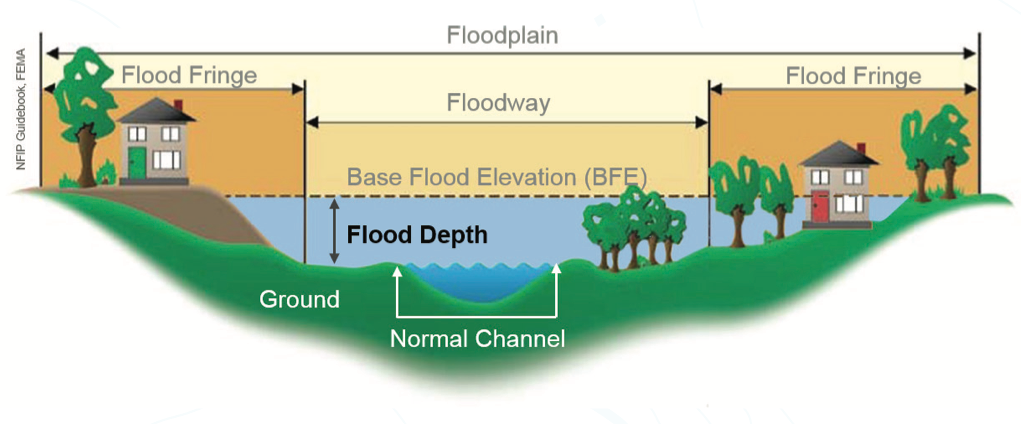
A floodplain, which consists of a floodway and a flood fringe, is the land adjacent to a stream or river that experiences occasional or periodic flooding.
415 West Washington
City of Ann Arbor Planning Commission is considering a proposal to rezone public land to PUD that is in a floodplain. The Concept Plan shows 157 residential units in a building constructed above the floodplain elevation, surface and understructure parking. Public open space is proposed, including construction of a segment of the Treeline trail through the site.
A challenge to the site is that it is in a FEMA designated floodplain. I was confused about this because there is no open water, stream, or river on this site. The water is flowing through a pipe.
What are the Floodway and Flood Fringe?
The Floodplain is an area of land that is vulnerable to flooding and is typically divided into two parts for regulatory purposes: the Floodway and the Flood Fringe.
The Floodway is the channel of the river or stream and the adjacent land that must remain free from obstruction to ensure that the 100-year flood can be conveyed downstream.
The Flood Fringe is the remaining portion of the floodplain. Communities can allow the flood fringe to be obstructed and developed if certain standards, such as elevating and floodproofing structures, are met.